Hey Internetpeople!
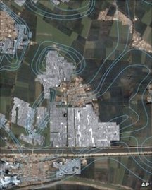
I wanted to bring to your attention a real cool (and famous) application of digital technologies to explore subjects in the humanities: in this case archaeology. Digitial Satellite mapping technologies such as Google Earth have made visible long-forgotten ruins, which would be of great interest to archaeologists but are invisible on the ground, or even from an airplane only so high about the surface of Earth.
Using Google Earth, the burried foundations of ancient Egyptian pyramids have been made visible as well as another project (using radar), in which an archaeologist used Google Earth to map out the streets of an unexcavated ancient Egyptian city. I think this is mind boggling! Using technologies in space to find what lies underneath the earth’s surface: saving money and time which guess work when it comes to finding archaeological sites and conducting survey work based on the composition of the soil and how ancient structures changed the soil structure.
How digital technologies further advance the humanities!
Google Earth Pyramids found: http://gizmodo.com/5934205/lost-egyptian-pyramids-appear-on-google-earth
